

 After 667km over the last 7 days, and a huge day coming up, I decided to make today a rest day. That way I will be ready for the 150km day that includes the Rogers Pass, one of the longest hills that I will climb on this trip. It's approximately 900 meters (~3,000 ft) of climbing elevation over 70km (~45 miles) before I get to do the very long downhill towards Golden.
We slept in late and Rochelle made her special no-carb pancakes for breakfast. We moved very slowly all day, catching up on email and I fixed some ArtSites bugs and worked on some new features.
 We are camped just outside of Revelstoke so we bicycled over the "Big Eddy" bridge across the Columbia River to the town site and rode around. Not much going on on a Sunday other than a number of nice restaurant patios. We also rode south along the river on a nice bicycle path on a dike. It was a nice, slow 10km to remind my body that the cycling is not over.
 The day tomorrow will be long so I have a plan to get away at 7am to give me plenty of time. We hope to have a break for lunch at the top of Rogers Pass. I figure it should take me approximately 6 hours to get there.
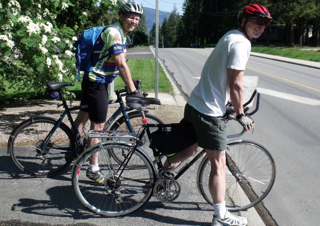 This morning, Lyle, one of our hosts, literally rode me out of town. He took me on a route that avoided one big hill for the start of the day. It was a late but fine start to the day that was sunny and had very little wind.
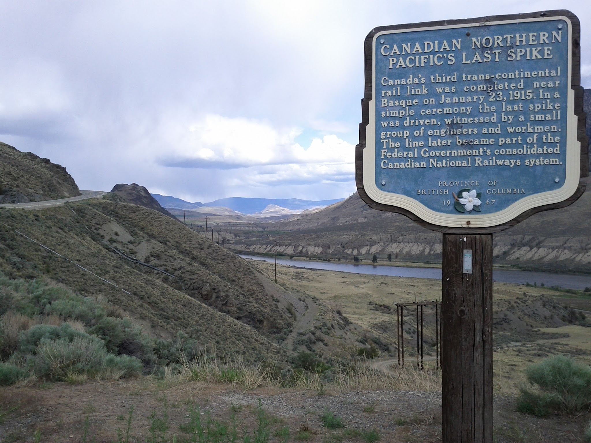
Unfortunately as the day progressed, the wind picked up and it was a headwind. I fought that for the rest of the day. The winding road provides a high view of the Shuswap lake (the Salmon Arm of Shuswap Lake) and eventually drops down at the east end in the town of Sicamous. 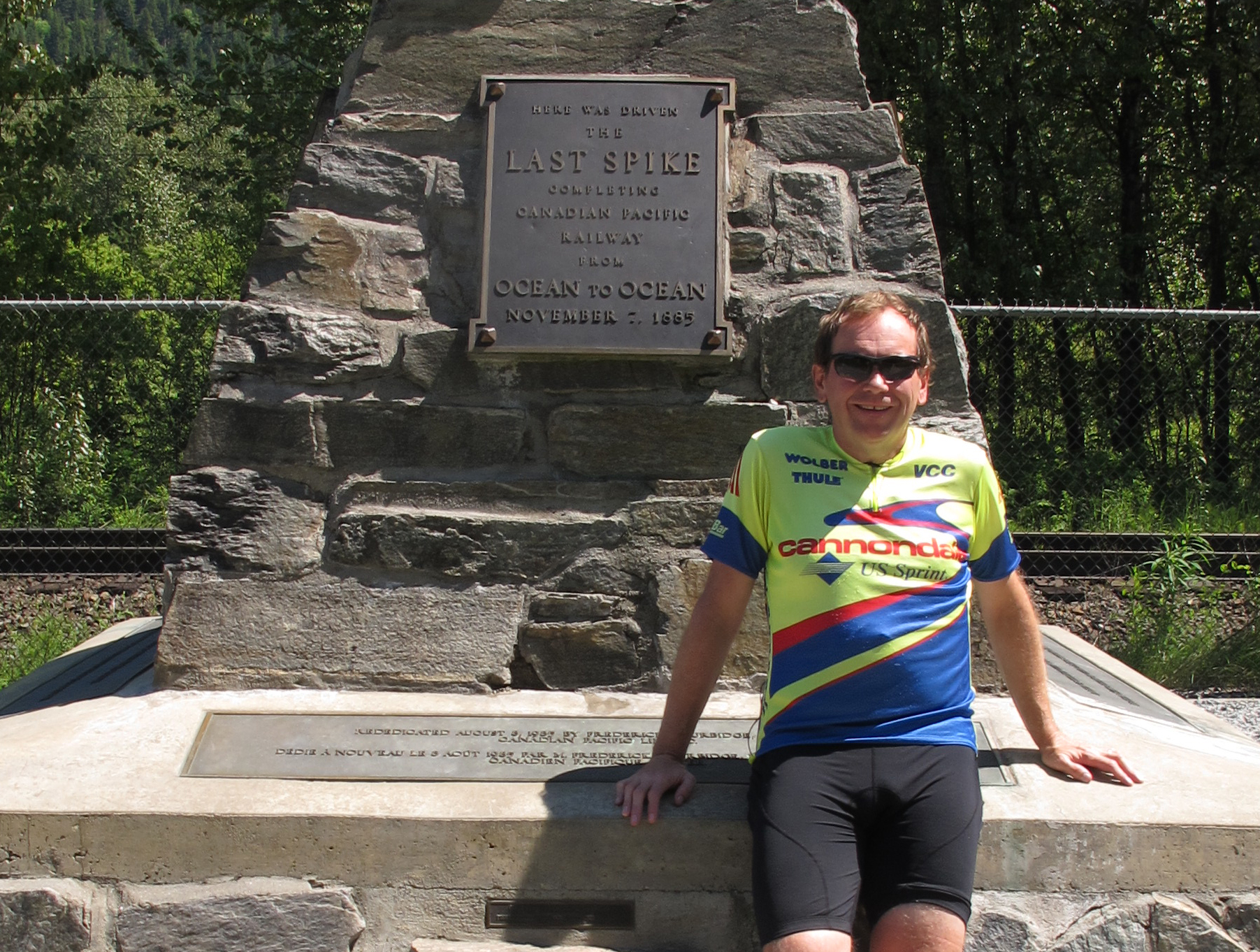 There were lots of flats from Sicamous to Craigellachie (where the last spike was driven on the Canadian National Railroad) but the headwinds kept my speed pretty low. Rochelle caught up to me just before Craigellachie and we stopped there for lunch.
The last 45km felt like it was all uphill with a headwind. I am pretty exhausted, having travelled 103km for the day. More exhausted that I would have expected even given the wind (maybe it's the 667km I've done in a week) so tomorrow might be a rest day before attacking Rogers pass. There is some bad weather coming in, maybe by Tuesday, so I was hoping to get as far east as I could to possibly miss that. Let's just hope that this storm is not too bad.
We've stopped at a nice campground on the west side of Revelstoke so we have a nice place for an extra day's stay. I don't think that I've ever really done anything here other than buy gas on the highway so exploring Revelstoke tomorrow will be a nice break.
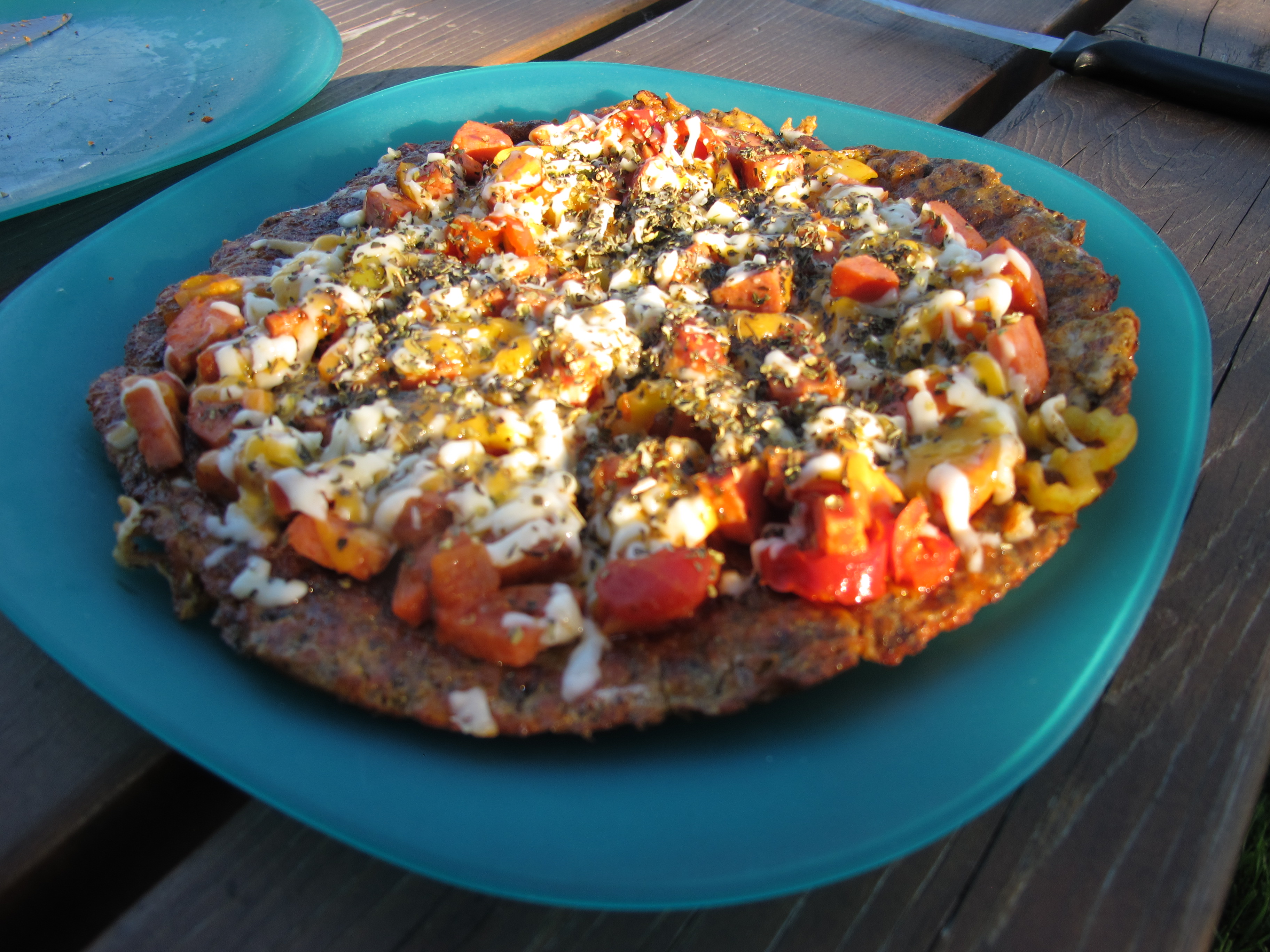
Tonight Rochelle made "Chilpotle Pizza" with no carbs and no oven. Amazing!
 It was another beautiful day cycling along the South Thompson River and into the Shuswap Lake area. It was shorts and short sleeves weather. I got away just after 9am and quickly got out of Kamloops. I had yet another good tail wind in the morning that propelled me to Chase, BC very quickly. There is a pretty good hill to climb just east of Chase and the wind turned around at the top of the hill so the rest of the day was in light headwinds. We planned lunch in Sorrento, BC but I had made such good time that I beat Rochelle there. Afterwards, I cycled the rest of the way to Salmon Arm. Total distance was 110km, the furtherest ride yet on this trip.
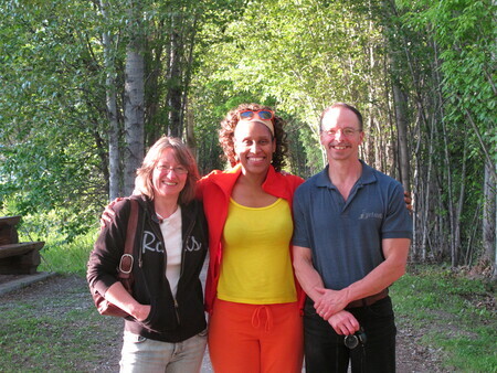
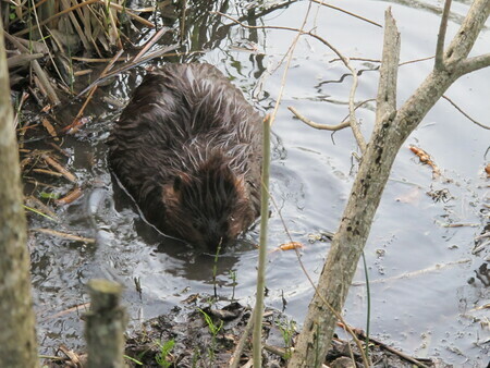 As a nice treat we met up with one of our ArtSites artists, Frieda Martin and her husband Lyle. They made us a great dinner and took us on a beautiful walk along Salmon Arm bay. While there, we saw a family of beavers busily working on various projects. What a wonderful way to end the day - great company, food, conversation, and nature's beauty!
Tomorrow it's off to Revelstoke, BC. It's just over 100km. This will likely be more hilly than today.
 Today was a relatively easy ride. It was a somewhat shorter 82km ride and I had a really good tail wind for most of the day. It was mostly sunny and warm so I dressed much lighter than I have done so far. It was a really beautiful day riding through the dry mountains of the Thompson River Valley. It's days like today that I was looking forward to when I first thought of this trip!
It was a mostly uneventful day other than I completely missed where Rochelle had stopped to setup for lunch. We only noticed this after I had gone another 11km. I never did get a good mount for my phone on my bicycle so it's not as convenient as I would like to check maps and where Rochelle is.
Riding into Kamloops and across to the "North Shore" was fun. All down quite steep hills. I'm glad I am not going out the same way tomorrow that I came in! We are staying in a nice little campground along the north side of the Thompson River.
I am now over 450km into my ride in 5 days. That's more than 5% of the journey! This is starting to feel more like something that I can really accomplish! Surprisingly, I still feel like I've got a lot of energy and have decided to do another 2 days of riding before taking a day off. This should put us in Revelstoke, BC. The next section between Revelstoke and Golden is the Rogers Pass and is likely to be the hardest day of the whole trip so having a rest day before sounds like a pretty good idea.
Today's tool find was a nice adjustable wrench. I might have a whole new tool box by the time I finish this trip.
Tomorrow we are off to Salmon Arm and will meet up with one of our ArtSites' artists! We're very much looking forward to that and will definitely take some pictures!
 After a great sleep in Lytton, I managed to get away at a more respectable 8:45am. The sun was already pretty warm so I dressed in lighter clothing, leaving the rain gear behind. The Thompson River is amazing to ride along. While the Fraser Cannon had some spectactular heights, you often could not actually see the river, it was so far down steep clifts. For most of today's travels, the Thompson was very close. You could hear it rushing in the opposite direction to my travel for much of the day.
The hills were not so bad today but there was constant up and down the whole way. Luckily, I had a great tail wind most of the way. About half way to Cache Creek I passed a large burnt section of road. It must have been a fiery accident. About 100m up the road, my rear wheel started to wobble and I could feel the rim running on the road. I must have run over some bit of melted metal that embedded itself in the wheel. It turned out to be a nice bit of wire. As I was fixing the tire, Rochelle caught up to me and stopped to keep me company as I fixed the flat. That end up being a good place for lunch.
 Just before lunch, I came across two big horned sheep grazing beside the road. They did not seem to be spooked by the cars and trucks going by, but they did seem to be spooked by me. One of them jumped a 1.5 meter fence with what seemed to be no effort at all. It almost looked like it floated over.
Today was a bit difficult coordinating our activities. We have no paper maps and did not have any internet access. I had a good sense of our route so I set a meeting point near Ashcroft but we missed each other. I waited a while in Ashcroft but Rochelle was using that time well, getting us a nice camp spot east of Cache Creek. I road the rest of the way around 5pm. It was a long 97km day. I was tired at the end of it, having now covered 372km in 4 days but I have recovered pretty well and hope to get to Kamloops tomorrow, another 82km to the east.
 The day started out with a light rain but that tapered off fairly quickly. I didn't get away until about 10:30. The goal was to have lunch in Boston Bar, about 68km north of Hope, and once there, see how I was feeling and how much more I could do.
 There were two 350 meter summits along the way to Boston Bar. That was a pretty good test for what will come in the future. They were long and fairly steep but I took it slow and got up them without a problem. I reached Boston Bar at about 2:30 to a wonderful lunch that Rochelle had ready. I felt pretty good so I took off at about 3:30 for Lytton, another 40km up the road. We had seen a number of campgrounds leading up to Boston Bar so we hoped we would see more near Lytton. No such luck. The only one we found was only a little cheaper than staying in a motel so we chose the motel. A little more comfortable than VanGo. After 104km of riding, I was ready for a comfy bed!
 Not long out of Hope I noticed that I lost cell service on my phone. I assumed that was just a bad spot but it turns out that only one of the three carriers has much service between Hope and Cache Creek and that was the only one that we did not have with us. To add to this problem, Lytton has a municipal WiFi system, which is very progressive, except that it was badly broken and we were unable to use it. As it was, we went for about 30 hours with no communications systems. It is amazing how dependant on these systems we have become.
It's interesting what you find along the side of the road when you travel at this speed. Just north of Hope I saw the remains of an iPhone spread out over a couple of hundred feet. Did the owner lose cell coverage just as I did? Later I saw a 3/4" socket as I moved slowly up a large hill. I stopped and picked it up. I also found a 6 pack of water bottle, still mostly in their plastic wrap. I wonder where that was in someone's load that it fell out?
We are in Hope, BC at nice little campground right on the Fraser River. After a great BBQ hamburger dinner, we are listening to Johnny Cash and working on our computers. Rochelle has created a wonderful setup that allows us to both work comfortably. Rochelle is even got a 24" monitor connected to her machine! We will get a picture of the setup online sometime soon. I have been extremely impressed how well Rochelle has packed the huge pile of stuff into this little camper van.
The 90km day started in Abbotsford in a light rain that waxed and waned all day. The rain almost stopped over the last 20km into Hope. The route was mapped out by Google Map's bicycle routing software. It was pretty good most of the way, routing me through beautiful farmland. One mistake it made was assuming that because the trace of two roads crossed that they actually connected. At one point I stood looking up at the road that I wanted to be on about 20 meters above my head. Not only that but at that point I have traversed about 2km of muddy, potholed road that would have been a challenge on a mountain bike, let alone my skinny road tires. I managed to find a trail that finally hooked up with the road that I wanted to be on. A nice little 5km of off-road that I had not expected for the day!
After a wonderful lunch in Agassiz that Rochelle had ready for me, I put back on my wet shoes, gloves, etc and headed out for the last 30km to Hope. It felt really good and I got into a nice rhythm with long straight, flat stretches with a couple of good sized hills that gave me a taste of what is ahead tomorrow.
After yesterday's ride, I thought I had destroyed my Nexus S phone but by midday today, most of the functionality had returned. It still has some problems with it's acceleration sensor (tells it which way is up) and the Bluetooth antenna that seems to break it's connection to my headset about once every 2 or 3 minutes. Hopefully those things will work themselves out too. Dodged a $600 bullet there.
Tomorrow we head north into the Fraser Canyon. There is not much along this stretch of highway even though it was the primary way people traversed the BC Rockies for years. That's likely because there is little flat land. It's about 65km to Boston Bar and 108km to the next town, Lytton so my ride will likely end somewhere in between and we will stay tomorrow night in the nearest town.
We had a slow start yesterday. It took considerably longer to get VanGo filled with all of the stuff that we wanted to take on the trip. In fact, I left before that work was done and Rochelle completed the task.
I got on my bike about 11:30am and started heading east. It was already starting to rain lightly so I dressed for rain. As it turns out, I didn't quite dress for what was to come. By the time I reached Burnaby, it was raining heavily. The rain seemed to get heavier as I travelled east.
The rain was so bad that I couldn't check the map on my phone as often as I would have liked and I ended up making a wrong turn in Surrey and didn't notice this until I was half way to the US border. Luckily I noticed this just at #10 highway and took that directly to Langley.
Rochelle and I had planned to meet in Langley but it took Rochelle longer that we thought to complete the packing so we decided to meet in Abbotsford instead. She caught up to me just west of Abbotsford. We stopped, had a meal and I tried to dry out a bit. My original plan was to get to Chilliwack, another 37km or so past Abbotsford but it was getting late and I was not having much fun in the rain so we decided to stay in Abbotsford for the night.
Here is the day's route. You will notice that it is missing the last bit into Abbotsford so it was actually 81 km. That is because my phone got wet in the sealed "waterproof" pocket of my rain jacket. I've mostly been able to revive it except for the 4 buttons on the bottom. It's almost impossible to use an Android phone without these buttons so I think that my phone is toast. I will have to start thinking about how to replace it. So the next few days won't likely have an Endomondo track or real-time location information until I can either repair my current phone or replace it.
Today's goal is Hope, BC. It's about 90 km. Plenty long enough for what is shaping up to be another heavy rain day.
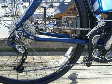 I got my MEC Côte road bike back yesterday. I've swapped out the rear cassette and derailleur with mountain bike gears. That way I'll be able to get up and over the passes crossing British Columbia.
Unfortunately MEC didn't do a good job of setting up the shifting (that's actually why I took it to them). So tomorrow it will be going back.
Now that the Vancouver Sun Run is over, it's time to focus on the big bicycle trip. My estimated start date, May 18, is just a month away and I need to focus more on the cycling. I have been doing lots of 60-80km training and even one 120km day but I need to start doing a lot more back-to-back long distance rides on consectutive days. Ultimately, I need to ride 100km per day for 6 our 7 days. That training starts today. If you want to follow any of my individual training rides, status notices will show up on my @GeoffsBicycle twitter feed.